Biography
Contrags that our three papers are selected as ESI highly cited papers!
I am looking for self-motivated PhD students, research assistants, and visiting scholars! Please drop me an email if you are interested in working with me!
Dr. Zhang Xiaokang (张效康) received a Ph.D. degree in photogrammetry and remote sensing from Wuhan University in 2018. He is currently a specially appointed professor in the School of Information Science and Engineering, Wuhan University of Science and Technology and a Research Associate at The Hong Kong Polytechnic University. His research interests include remote sensing image analysis and machine learning. He has authored or coauthored more than 40 scientific publications in international journals and conferences. He is an IEEE Senior Member and a Reviewer for more than 30 renowned international journals. For more information, please refer to my personal introduction in Chinese at https://luojianet.whu.edu.cn/info/1141/1471.htm.
- Remote sensing
- Computer vision
- Deep learning
PhD in Wuhan University, 2018
Supervisor: Prof. Wenzhong SHI and Prof. Jianyan Gong
MEng in Wuhan University, 2013
Supervisor: Prof. Jianya Gong ( Academician of Chinese Academy of Science)
Experience
Academic Service
Featured Publications
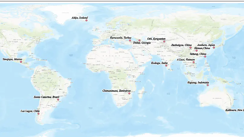
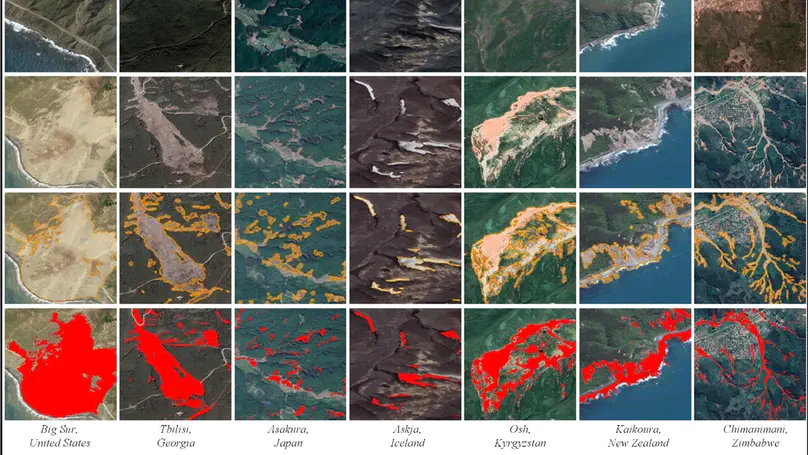
Landslide mapping via pixel-wise classification of remote sensing imagery is essential for hazard prevention and risk assessment. Deep-learning-based change detection greatly aids landslide mapping by identifying the down-slope movement of soil, rock and other materials from bitemporal images, benefiting from the feature representation capabilities of convolutional neural networks. However, these networks rely on large amounts of pixel-level annotated data to achieve their promising performance and they normally exhibit weak generalization capability on heterogeneous image data from unseen domains. To address these issues, we propose a prototype-guided domain-aware progressive representation learning (PG-DPRL) method for cross-domain landslide mapping from large-scale remote sensing images based on the multitarget domain adaptation (MTDA) technique. PG-DPRL attempts to learn a shared landslide mapping network that performs well in multiple target domains with no additional effort for sample annotation. Specifically, PG-DPRL adopts a near-to-far adaptation strategy to gradually align the representation distributions of all target domains with the source domain, considering discrepancies between them. On this basis, cross-domain prototype learning is exploited to generate reliable domain-specific pseudo-labels and aggregate representations across domains to learn a shared decision boundary. In each DPRL step, the prototype-guided adversarial learning (PGAL) algorithm is performed to achieve category-wise representation alignment and improve the discriminative capability of representations by introducing the Wasserstein distance metric and cross-domain prototype consistency (CPC) loss. Experiments on a global very-high-resolution landslide mapping (GVLM) dataset consisting of 17 heterogeneous domains from different landslide sites demonstrate the effectiveness and robustness of PG-DPRL. It considerably improves the transferability of landslide mapping networks and outperforms several state-of-the-art approaches in terms of total and average accuracy metrics among all target domains.

We propose multilevel deformable attention-aggregated networks (MLDANets) to effectively learn long-range dependencies across multiple levels of bitemporal convolutional features for multiscale context aggregation. Specifically, a multilevel change-aware deformable attention (MCDA) module consisting of linear projections with learnable parameters is built based on multihead self-attention (SA) with a deformable sampling strategy. It is applied in the skip connections of an encoder–decoder network taking a bitemporal deep feature hypersequence (BDFH) as input. MCDA can progressively address a set of informative sampling locations in multilevel feature maps for each query element in the BDFH. Simultaneously, MCDA learns to characterize beneficial information from different spatial and feature subspaces of BDFH using multiple attention heads for change perception. As a result, contextual dependencies across multiple levels of bitemporal feature maps can be adaptively aggregated via attention weights to generate multilevel discriminative change-aware representations.
Recent Publications
Conference

Contact
- natezhangxk@gmail.com
- 947 Heping Avenue, Qingshan District, Wuhan, Hubei 518172
- Steel Building
